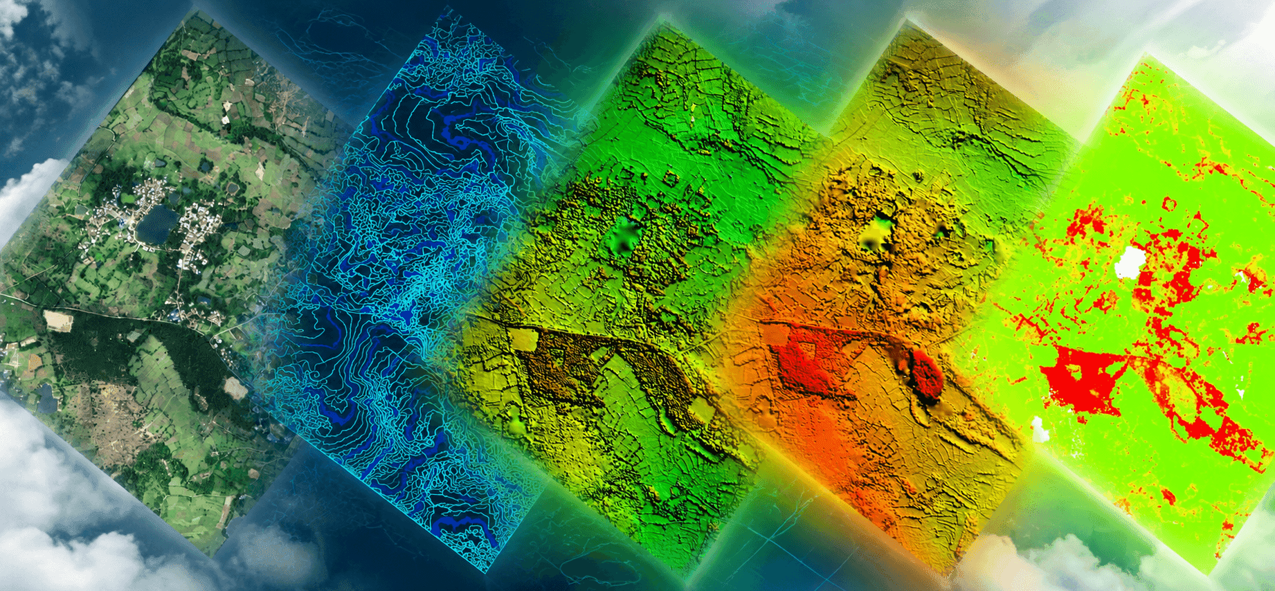
Drone Data Processing for Project-Ready Maps and Models
We process client-supplied drone imagery and LiDAR data into orthomosaics, classified point clouds, terrain models, contours and GIS/CAD deliverables.
FROM RAW DATA TO USABLE DELIVERABLES
The Flight Is Complete. The Mapping Work Is Not.
Drone photographs and point clouds become useful only after they are checked, processed and structured for their intended purpose. A visually good orthomosaic may be suitable for site reference, but engineering, terrain or GIS/CAD work can require additional control, classification and quality checks.
Techmapperz supports processing-only assignments using data captured by clients, drone operators and project contractors. Depending on the available inputs and agreed scope, our work can continue from photogrammetry and LiDAR processing to terrain products, profiles, sections, feature extraction and final GIS/CAD preparation.
Before confirming the workflow, we review image overlap and sharpness, geotags or flight metadata, GCP/RTK/PPK information, coordinate reference system, point-cloud condition and expected outputs. If the source data has limitations, we explain what can be produced reliably before full processing begins.
What We Review First:
Overlap & Sharpness
GCP & RTK/PPK Data
CRS & Datum Alignment
Point Cloud Density
CORE PROCESSING CAPABILITIES
Data Processing Services for Imagery, LiDAR and Mapping Outputs
Orthomosaic Production
Georeferenced orthomosaics prepared in the agreed coordinate system, resolution and tiling plan. Coverage gaps, visible distortion and seam issues are reviewed and corrected where the source imagery allows.
True-scale orthophoto mosaics
Coordinate reference system alignment
Seamline editing & color balancing
Tiled GeoTIFF delivery
LiDAR Point-Cloud Processing
LAS/LAZ data review, noise identification, cleaning, classification and ground/non-ground separation. Required classes and feature groups are agreed before production begins.
LAS / LAZ point cloud cleaning
Ground & vegetation classification
Powerline & building separation
High-density filtering
Terrain & Elevation Products
DTM, DSM, DEM, contours, slope and surface products prepared from suitable classified point clouds. Cut-fill or stockpile volumes can be calculated where the required boundaries and reference surfaces are available.
Digital Terrain Model (DTM)
Digital Surface Model (DSM)
Topographic contour generation
Stockpile & cut-fill volume calculation
Profiles, Sections & Corridor Drawings
Longitudinal profiles, cross-sections, L-sections and gradient drawings for railway, road, pipeline and other corridor assignments, prepared at agreed intervals and drawing standards.
Longitudinal profiles (L-sections)
Cross-sections at set intervals
Gradient & slope drawings
Corridor alignment mapping
Photogrammetric Reconstruction
Image alignment, camera optimisation and dense reconstruction from suitable overlapping drone photographs. Depending on the project, outputs can include an aligned image block, dense RGB point cloud and 3D surface or mesh.
Multi-ray bundle block adjustment
Dense RGB point clouds
3D textured surface meshes
Camera calibration & optimization
GIS/CAD Feature Extraction
Specified visible features—such as roads, railways, buildings, utilities, water bodies, mine features and land parcels—captured into structured GIS or CAD layers with the required attributes and layer organisation.
A Practical Workflow from Data Review to Final Delivery
01
Data & Requirement Review
We check the project boundary, source files, metadata, control information, coordinate system, required outputs and available reference documents.
02
Scope Confirmation
We confirm the processing stages, deliverables, format, data limitations, review checkpoints and production schedule before starting the full dataset.
03
Processing & Production
Imagery or point-cloud processing is completed according to the approved workflow, followed by terrain preparation, feature extraction or engineering drawing production where required.
04
QA/QC & Client Review
Outputs are checked for projection, coverage, classification, geometry, completeness, attributes and file structure. Agreed review files are then shared for comments.
05
Final Delivery
Approved comments are addressed before the final GIS, CAD, raster, point-cloud, drawing and reporting package is organised and submitted.
WHERE WE CAN SUPPORT
Drone Data Processing for Different Project Requirements
Infrastructure & Transportation
Orthomosaics, terrain models, contours, corridor profiles and mapping outputs for roads, railways, bridges and construction assignments.
Mining & Natural Resources
Mine-feature mapping, haul-road extraction, surface models, stockpile volumes, contours and change or surface-comparison outputs.
Utilities & Pipelines
Corridor terrain products, alignment mapping, asset and feature extraction, profiles, cross-sections and GIS/CAD preparation.
Land Development & Planning
Existing-condition maps, terrain surfaces, contours, land and site features, planning base maps and CAD/GIS datasets.
Agriculture & Plantations
Farm or plantation boundaries, terrain and elevation products, drainage-related mapping and feature extraction from suitable imagery or LiDAR data.
Drone & Survey Companies
Processing-only support for organisations that capture their own drone or LiDAR data but require additional production capacity or GIS/CAD deliverables.
SELECTED PROJECT EXPERIENCE
Drone LiDAR Survey & Mapping for a 173 km Railway Corridor
RAILWAY CORRIDOR MAPPING
173 km Drone LiDAR & Topographic Mapping Assignment
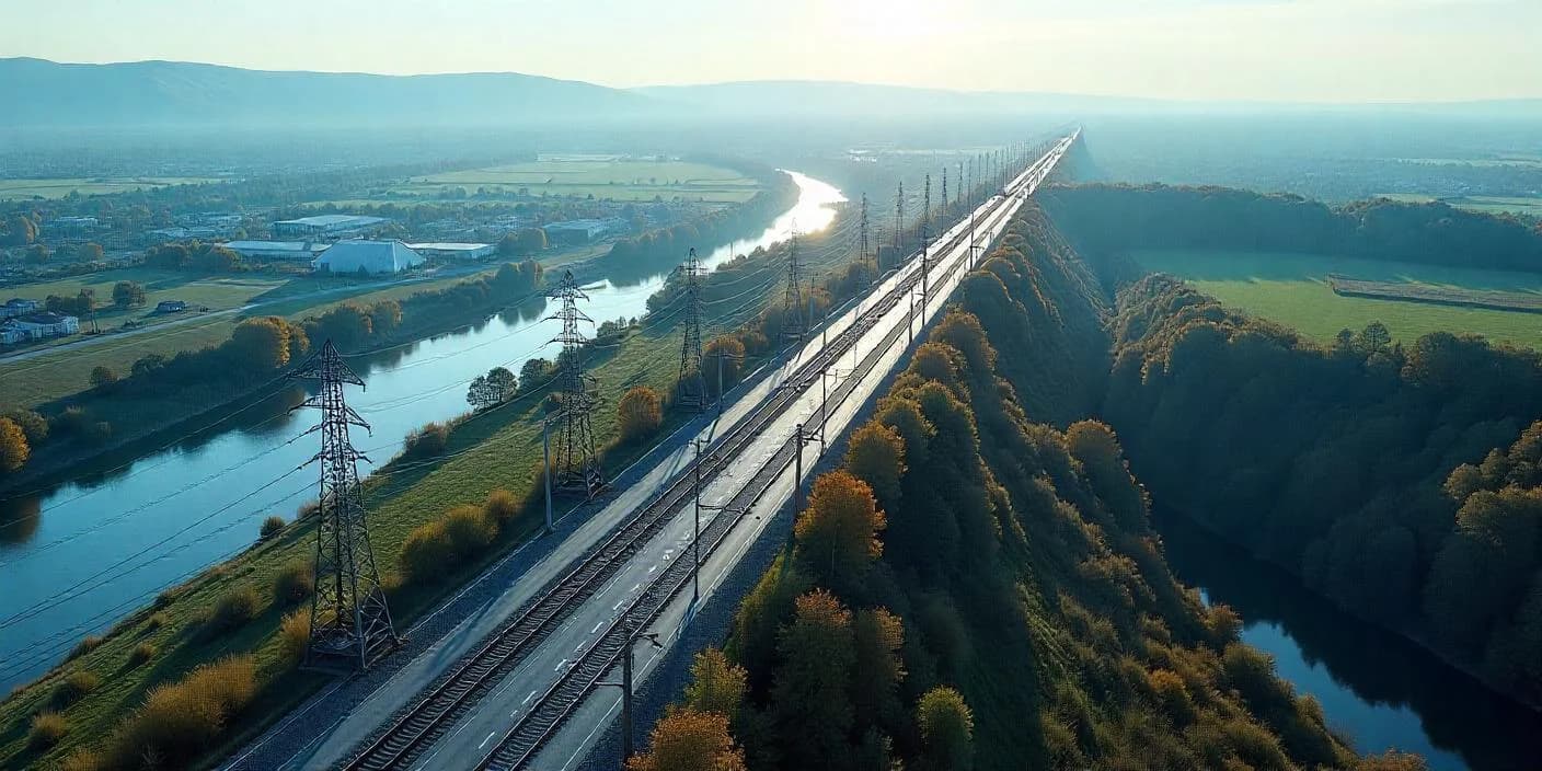
Techmapperz carried out a Drone LiDAR and topographic survey along a 173 km railway corridor, covering an approximately 100 m-wide survey band through rural, semi-urban and agricultural areas.
The work extended beyond aerial data capture. LiDAR point clouds and synchronized RGB imagery were processed to prepare terrain models, orthomosaics, contours and CAD/GIS topographical maps. The terrain information was further used to produce cross-sections, longitudinal sections and gradient drawings required for railway corridor planning and engineering use.
KEY PROJECT DELIVERABLES
Drone LiDAR point-cloud data
DTM and DSM preparation
Orthomosaic generation
Minor and major contours at 1 m and 5 m intervals
CAD/GIS topographical maps at 1:5,000 scale
Cross-sections, L-sections and gradient drawings
WHY TECHMAPPERZ
Practical Support from Data Review to Final Mapping
Processing-Only Assignments
We can begin with imagery or point-cloud data already captured by your team, without repeating the field survey.
Inputs Reviewed Before Commitment
Coverage, metadata, control, coordinate system and requested outputs are reviewed before the full production workflow is confirmed.
Photogrammetry, LiDAR & GIS/CAD Together
The assignment can continue from raw imagery or point clouds through terrain preparation, feature extraction and final mapping outputs.
Support for Engineering Drawings
Profiles, cross-sections, L-sections and gradient drawings can be included where the terrain data and project specification support them.
Project-Specific Delivery
Coordinate system, layer structure, file formats, drawing standards and review stages are agreed for each assignment.
Structured QA/QC
Outputs are reviewed for projection, coverage, classification, geometry, attributes, completeness and final file organisation.
COMMON QUESTIONS
Frequently Asked Questions
Yes. We regularly consider processing-only assignments using client-supplied drone imagery or LAS/LAZ point clouds. We first review sample files, available metadata, project boundary, control information and required outputs.
START YOUR PROCESSING PROJECT
Have Drone Data Ready for Processing?
Send your drone imagery or LiDAR point cloud with any available survey control. We’ll review the inputs and confirm the required mapping and GIS/CAD outputs.