
Loading Techmapperz...
Loading Techmapperz...
A GIS-based riverfront mapping and land-use analysis project covering 100 sq. km in the Kolkata Metropolitan Area, integrating spatial, socio-economic and infrastructure information for development planning.
Techmapperz carried out a GIS-based mapping and land-use analysis project along both banks of the Hooghly River in the Kolkata Metropolitan Area.
The project aimed to develop a comprehensive geospatial database supporting urban planning, tourism development and sustainable riverfront management.
The work combined spatial mapping, land-use analysis and socio-economic data integration to support riverfront development and improved urban connectivity.
Riverfront development requires a clear understanding of land use, commercial activity, infrastructure and connectivity across the study area.
The project required:
Techmapperz developed a GIS-based spatial database combining land-use mapping, infrastructure analysis and socio-economic information.
The project included mapping major assets and transport links within the riverfront buffer and analysing commercial activity across 15 key jetties, Barabazar and surrounding waterfront zones.
Defined the riverfront study area, buffer zones and required datasets.
Mapped land use, infrastructure, transport links and key riverfront assets.
Analysed commercial activity and land-use patterns across key waterfront areas.
Integrated socio-economic, heritage and business datasets within GIS dashboards.
Developed structured geospatial outputs to support riverfront planning and development.
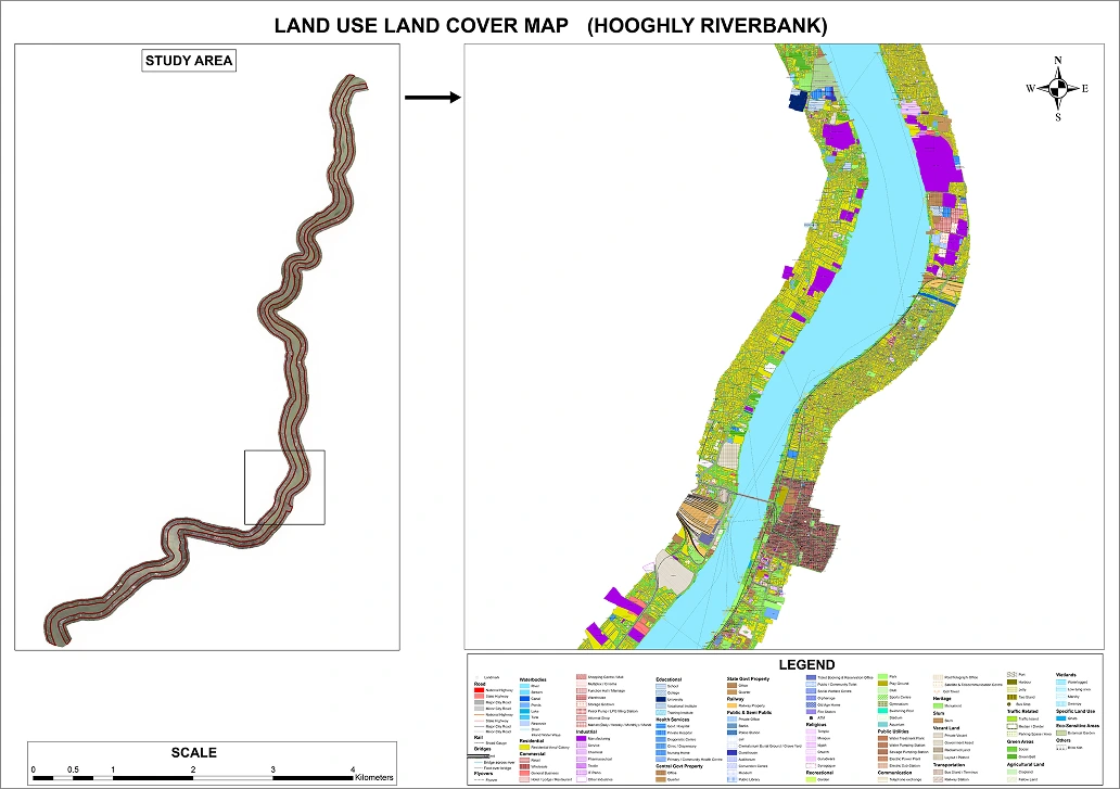
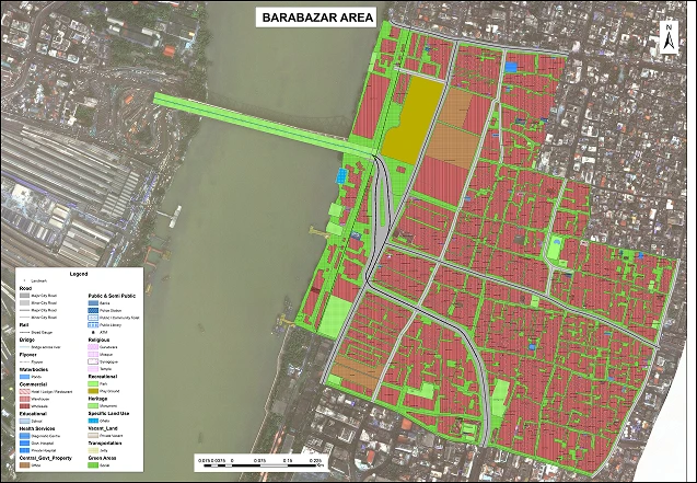
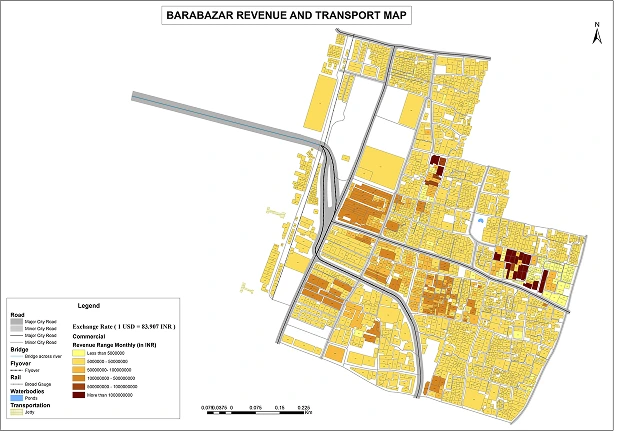
The project created a comprehensive geospatial dataset for riverfront planning and urban development.
The GIS platform provides a spatial framework for long-term riverfront management and economic development.