
Loading Techmapperz...
Loading Techmapperz...
A GIS-based digital asset registry for a 6,000 km natural gas pipeline network, including pipeline layers, asset attribution databases and hazard mapping. The system enables centralised monitoring, improved safety analysis and data-driven pipeline management.
Techmapperz executed a GIS-based digitisation and digital asset registry project for a large-scale natural gas pipeline network.
The project covered a 6,000 km pipeline system, focusing on creating a centralised geospatial database of pipeline infrastructure and associated facilities.
The objective was to enable efficient monitoring, risk assessment and data-driven infrastructure management through a structured digital system.
Managing a large pipeline network requires accurate, centralised and accessible asset data.
For this project, the key challenges included:
Techmapperz implemented a GIS-based digitisation approach to convert pipeline infrastructure data into a structured and centralised geospatial system.
Detailed GIS layers and an asset attribution database were developed to enable clear mapping of pipelines, valves and associated facilities. Spatial analysis was applied to identify hazard zones and risk areas, supporting safer and more efficient pipeline operations.
Analysed existing pipeline data and defined database structure requirements.
Converted pipeline and infrastructure data into structured GIS layers.
Built a centralised geospatial asset registry with detailed asset attribution.
Performed hazard and risk mapping along pipeline corridors.
Delivered a scalable GIS-based system for monitoring and infrastructure management.
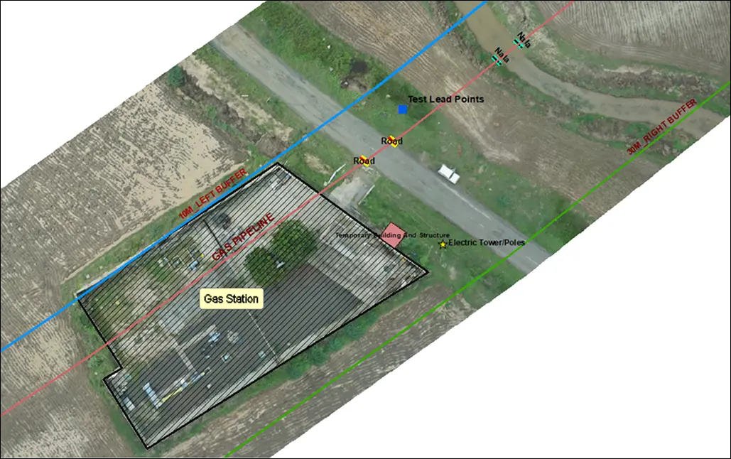
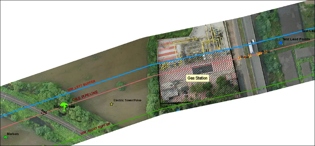
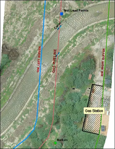
The project delivered a centralised digital asset registry that improved pipeline monitoring and infrastructure management.
The GIS-based system provides a structured digital foundation for long-term pipeline infrastructure management and expansion planning.