
Loading Techmapperz...
Loading Techmapperz...
A 45 km drone-based pipeline survey and GIS digitisation project delivering high-resolution aerial imagery, pipeline asset mapping and structured spatial data for infrastructure monitoring and maintenance planning.
Techmapperz conducted a drone-based aerial mapping and GIS digitisation project for an ammonia and water pipeline network in Gujarat.
The project covered a 45 km pipeline network, capturing high-resolution aerial imagery and converting the information into a precise geospatial asset database.
The objective was to support pipeline monitoring, operational safety and maintenance planning through accurate spatial information.
Pipeline infrastructure requires accurate spatial information to support monitoring, safety and maintenance activities.
For this project, the key requirements included:
Techmapperz combined UAV-based aerial surveying with GIS asset digitisation to capture and organise pipeline infrastructure data.
High-resolution drone imagery was processed into GIS datasets, enabling accurate mapping of pipeline alignments, associated facilities and surrounding terrain conditions. Spatial analysis was also applied for encroachment detection and terrain risk assessment.
Defined the pipeline survey scope and spatial data requirements.
Captured high-resolution aerial imagery across the pipeline corridor.
Processed imagery and digitised pipeline assets and facilities.
Performed spatial analysis for infrastructure monitoring and terrain risk assessment.
Delivered structured GIS data for pipeline monitoring and maintenance planning.
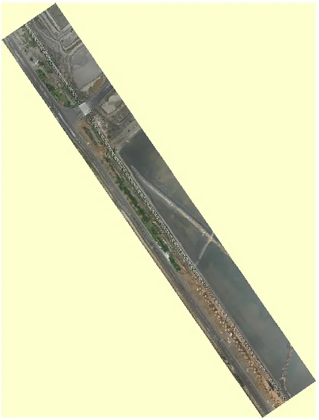
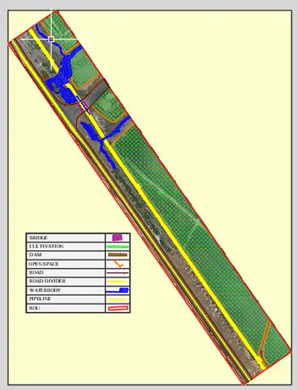
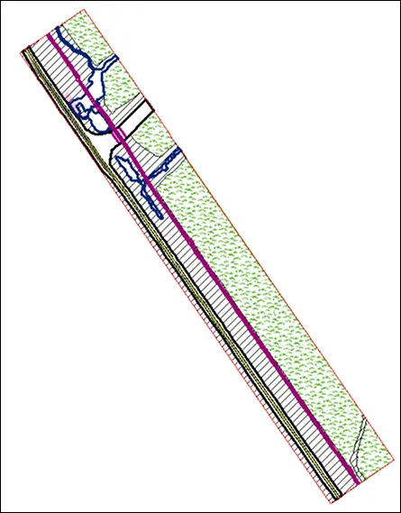
The project created a high-accuracy geospatial pipeline asset database supporting infrastructure monitoring.
The solution provides a reliable GIS-based framework for pipeline asset management and infrastructure monitoring.