Processing drone data is an essential part of converting raw aerial imagery into some useful geospatial products. We capture large scale data using drone, harnessing LiDAR technology to deliver various outputs including high-precision maps and 3D models, as well as analytical outputs. Such processed data sets allow industries including construction, agriculture, urban planning and environmental monitoring to make informed decisions with unparalleled accuracy and efficiency. We utilize state-of-the-art methods to process drone data and ensure that the othomosaics are of high-resolution to optimise project planning, asset management, and spatial analysis.
Our Drone Data Processing Services
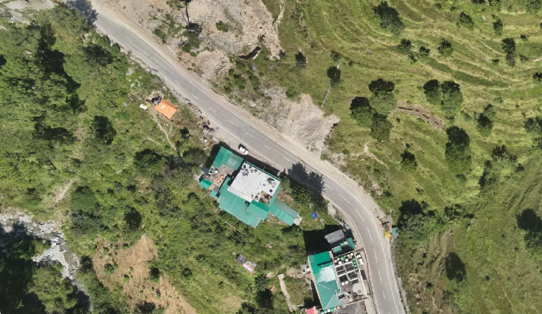
Image Stitching Orthomosaic Generation
We stitch images together to create high resolution, georeferenced orthomosaic maps. Such maps render the surveyed area accurately without distortion and can be used for land surveying, infrastructure planning, environmental monitoring, and many other applications.
Point Cloud Processing
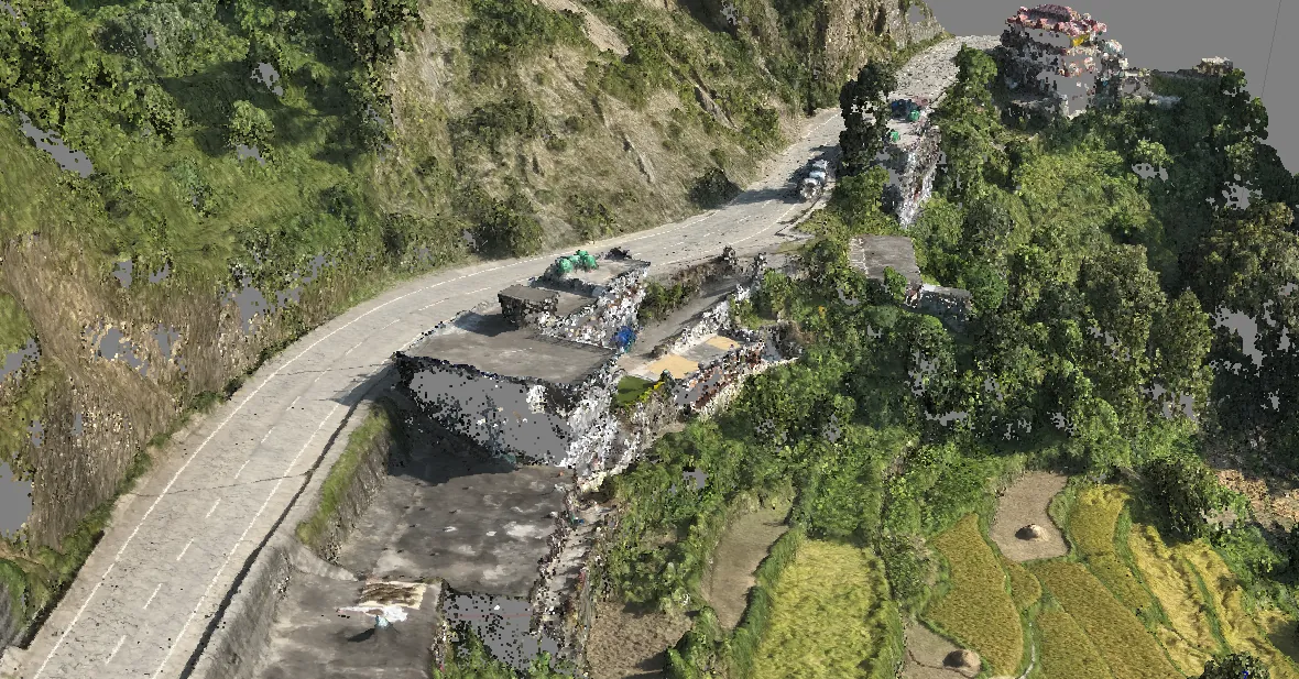
LiDAR point cloud data processing ranges from raw to dense point cloud. Such datasets provide a comprehensive understanding of terrain and structuresand may be used for volume computations, burial studies, and digital twin modeling.
Digital Surface Model (DSM)
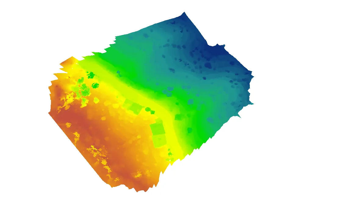
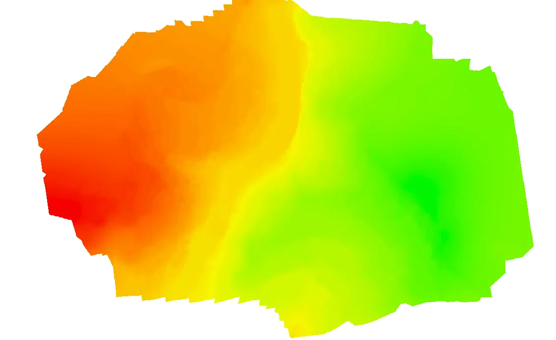
DSM shows the Earth's surface, including buildings, vegetation and other structures. This data is valuable for line-of-sight calculations, urban planning and flood risk, providing a detailed topographical view.
Digital Elevation Model (DEM)
We produce high-accuracy digital elevation models (DEMs) of terrain on the earth’s surface. Digital Elevation Models are utilized for various applications, including hydrological modeling, cost-sharing, development projects, and infrastructure design.
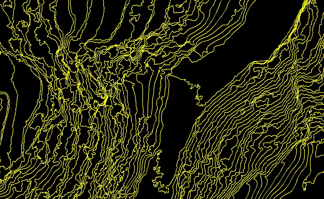
Contour Mapping
We create contour maps to pinpoint different elevation levels and the morphology of terrain in detail. These maps are critical for engineering, mining and agriculture, allowing professionals to plan excavation, drainage and land use projects.
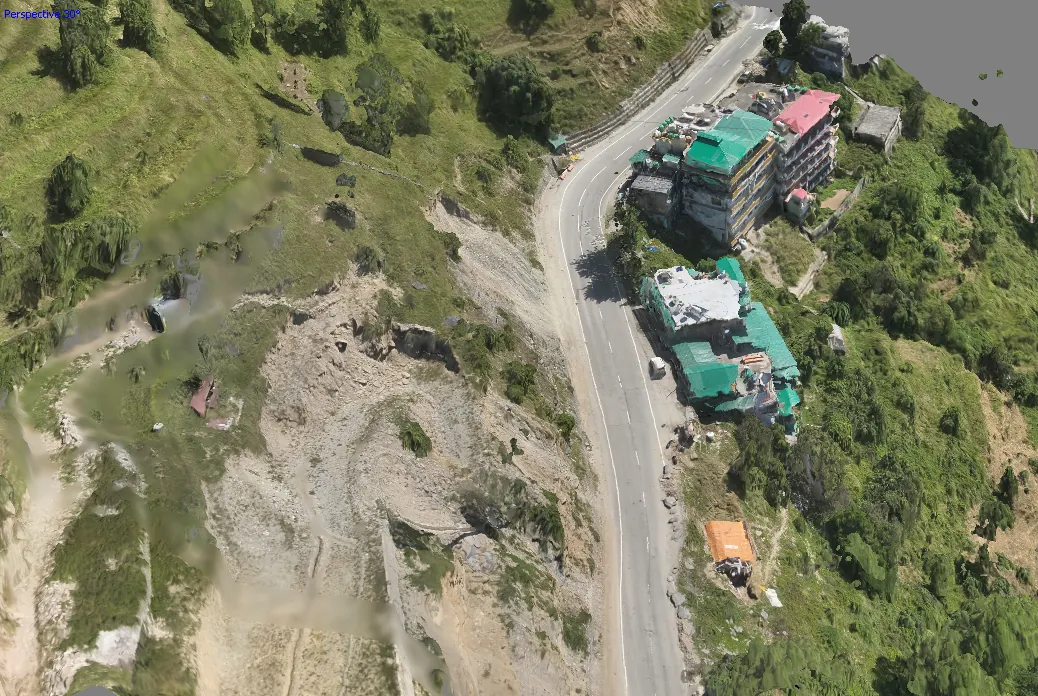
3D Mesh Modeling
We are Drone Data Providers who provides and generates highly detailed 3D mesh models extracted from drone data, a feature-rich output gaining popularity in several applications and industries. These models are popular in virtual reality applications, for monitoring construction progress, and for asset inspections.